Kyzyl-Oi
Red-Cliff Village on the Kokomeren — Cycling & Community Stays
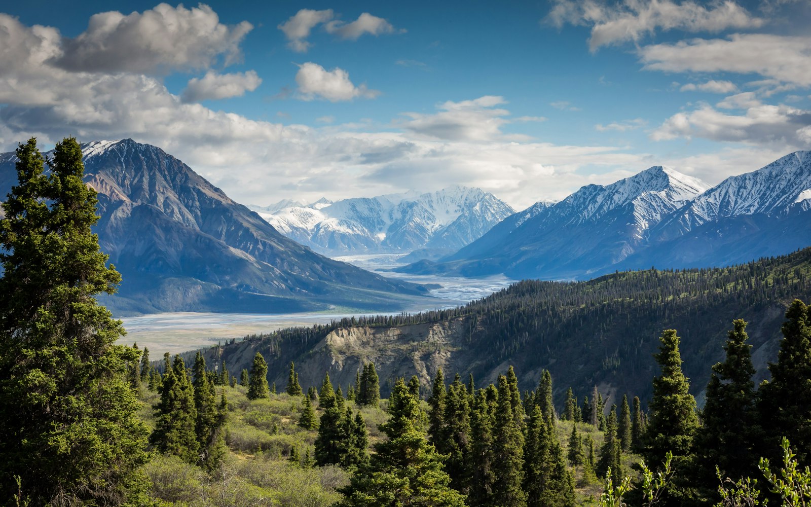
About Kyzyl-Oi
Kyzyl-Oi ("red valley") is a small settlement etched into ochre cliffs above the Kokomeren River in Naryn Oblast — roughly halfway along the dramatic mountain road that many overlanders use between Bishkek-region Suusamyr and the Naryn basin. The village name matches the geology: iron-rich slopes glow rust-red at sunset, framed by snow streaks on higher Tian Shan ridges. It has become a favourite pause for cycle tourers, motorbike travellers, and photographers who want authentic jailoo-edge hospitality without the Song-Kul crowds.
Community guesthouses and CBT-style hosts offer beds, family meals, and stories about winter isolation when passes close. There is no "attraction ticket" — the value is landscape, river soundtracks, and walking the upper tracks for panoramas. Mountain bikers often stage Kyzyl-Oi between Suusamyr valley riding and Naryn or Song-Kul legs; read our Karakol and Jyrgalan MTB chapters if you want singletrack after you reach Issyk-Kul.
Road condition matters: snow and rockfall can delay spring openings; 4WD shuttles appear in peak summer. Do not assume hourly public transport — negotiate shared taxis from Bishkek via Suusamyr or from Naryn depending on direction. Nights are cool even in July; pack a wind shell for ridge walks.
Ethical travel note: cash payments should go to resident hosts and licensed drivers; avoid staging drones over private yards without consent. This stop rewards travellers who enjoy slow mileage and conversation more than checklist monuments.
Highlights
Things to Do
How to Get There
No direct airport — route by road. From Bishkek, drivers cross Too-Ashuu toward Suusamyr then climb toward Kyzyl-Oi (full day with breaks, often arranged as private transfer $80–140 depending on vehicle). From Naryn, expect roughly 2–3 hours west by shared taxi when roads are open — confirm same-week with CBT Naryn or your guesthouse. Cyclists self-power the corridor with food carries between villages.
Where to Stay
Several family guesthouses ($18–40/night with meals common). Book ahead in July–August when cycle groups pass. Wild camping is possible outside the village core with host permission and leave-no-trace discipline — not inside private pastures without asking.
Pro Tips
- 1Confirm Too-Ashuu and Kokomeren tunnel status after storms — landslides happen
- 2Carry cash; ATMs are distant until Naryn or Bishkek
- 3Pair with Song-Kul or Naryn city pages for a coherent high-plateau itinerary
- 4Our mountain biking guide covers gear prep; Karakol-focused singletrack comes later on the same trip
- 5Respect livestock gates — herders move animals through the main road daily
- 6Satellite messengers help when mobile data drops in the gorge
- 7Learn five Kyrgyz phrases — hosts often speak little English
- 8Kyzyl-Oi vs Kazarman: both break long drives—Kyzyl-Oi suits red-cliff photography and a Kokomeren pause; Kazarman sits further south on the spine toward Jalal-Abad—pick by pass weather, not Instagram order
Book Your Trip
Find accommodation, tours, and transport for Kyzyl-Oi.
We may earn a commission from bookings made through these links at no extra cost to you. Affiliate disclosure.
Kyrgyzstan Travel Updates
Get seasonal tips, new route alerts, and travel advisories delivered to your inbox.
No spam. Unsubscribe anytime.
Location
41.7833°N, 74.2833°E
Frequently Asked Questions
How do I get to Kyzyl-Oi?
No direct airport — route by road. From Bishkek, drivers cross Too-Ashuu toward Suusamyr then climb toward Kyzyl-Oi (full day with breaks, often arranged as private transfer $80–140 depending on vehicle). From Naryn, expect roughly 2–3 hours west by shared taxi when roads are open — confirm same-week with CBT Naryn or your guesthouse. Cyclists self-power the corridor with food carries between villages.
When is the best time to visit Kyzyl-Oi?
June–September for reliable pass access and guesthouse openings; May and October for hardy travellers who confirm road status daily; winter is expert-only with local drivers.
Where can I stay in Kyzyl-Oi?
Several family guesthouses ($18–40/night with meals common). Book ahead in July–August when cycle groups pass. Wild camping is possible outside the village core with host permission and leave-no-trace discipline — not inside private pastures without asking.
How difficult is Kyzyl-Oi?
Kyzyl-Oi is rated Moderate. Altitude: ~1,800 m. Recommended duration: 1–2 nights typical for cyclists and photographers; pass-through lunch stops possible.
What activities are available at Kyzyl-Oi?
Mountain biking, Bikepacking, Photography, Village walks, River viewpoints, Community homestays, Road-trip staging, Stargazing.
Keep Planning Your Trip
Everything you need to turn Kyzyl-Oi into a complete trip.
You Might Also Like
 Moderate
At-Bashy
Naryn Oblast
High-Plateau Town — Tash Rabat & Border-Country Staging
 Easy
EasyKochkor
Naryn Oblast
The Felt Capital and Launch Pad for Song-Kul
EasyNaryn
Naryn Oblast
Kyrgyzstan's Highest Regional Capital — Gateway to Song-Kul and Tash-Rabat
 Easy
EasyTalas Valley
Talas Oblast
Birthplace of Manas — Heart of Kyrgyz Epic Heritage